
How Drone Tech is Transforming Mining Photography
Mining photography is no longer just about capturing images for reports or marketing.

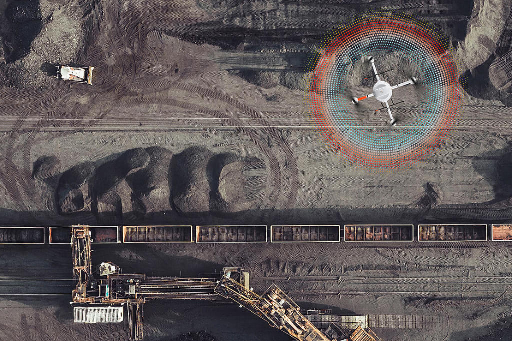
Mining photography is no longer just about capturing images for reports or marketing. It has become a critical operational tool that supports measurement, inspection, planning, and compliance. The shift is driven by drone technology, which has introduced speed, precision, and repeatability into how mining environments are documented.
With the growing adoption of drone mining inspection workflows and flexible models such as drone-as-a-service (DaaS), mining companies are turning aerial photography into a reliable data source rather than a visual afterthought.
From Documentation to Data Capture
Traditionally, mining photography relied on ground crews and occasional aerial surveys. These methods were slow, expensive, and often inconsistent. A survey team might take days to document a site, and the results could vary depending on conditions and human error.
Drone technology changes this dynamic by standardizing how images are captured. Pre-programmed flight paths ensure the same area is photographed consistently every time. This consistency is what turns images into comparable datasets.
Instead of asking, “What does the site look like?”, companies can now ask:
- How much material has changed since last week?
- Are slopes becoming unstable?
- Is production aligned with projections?
These are operational questions answered through structured aerial photography.
Real-World Example: Open-Pit Mining in Western Australia
An open-pit gold mine in Western Australia faced recurring delays in surveying and inspection. Ground teams were required to access steep, potentially unstable areas, which slowed operations and introduced safety risks.
After integrating drone-based workflows:
- Daily aerial photography replaced weekly manual surveys
- Hazardous zones were inspected remotely
- Site managers received updated orthomosaic maps within hours
The result was a measurable improvement in both safety and decision-making speed. Instead of waiting days for updated visuals, teams could act on near-real-time data. This is a practical demonstration of how drone mining inspection directly enhances productivity while reducing exposure to risk.
Core Applications of Drone Photography in Mining
Drone technology is not limited to one function. It supports multiple critical activities across mining operations.
1. Stockpile Measurement and Inventory Tracking
One of the most impactful uses of drone photography is stockpile analysis. Drones capture overlapping images, which are processed into 3D models, enabling accurate volume calculations.
Operational impact:
- Eliminates guesswork in material estimation
- Reduces disputes with contractors and suppliers
- Enables frequent inventory updates without downtime
2. High-Resolution Site Mapping
Drone photography is used to create orthomosaic maps, geometrically corrected images that represent the earth’s surface accurately.
Why it matters:
- Provides a current and detailed view of the site
- Supports planning for drilling, blasting, and hauling
- Improves coordination between teams
Unlike traditional maps, these can be updated regularly, ensuring decisions are based on the latest conditions.
3. Safety and Compliance Inspections
Safety remains a major concern in mining. Inspecting high walls, tailings dams, and confined areas can put workers at risk.
Drones allow these inspections to be conducted remotely.
Key benefits:
- No need for personnel to enter hazardous zones
- Faster identification of structural issues
- Visual records for compliance and audits
This is where drone mining inspection becomes essential, not optional.
4. Progress Monitoring and Reporting
Mining projects often involve multiple phases, from excavation to rehabilitation. Drone photography provides a consistent way to track progress.
Use cases:
- Comparing site conditions over time
- Documenting project milestones
- Sharing visual updates with stakeholders
Because the data is visual and measurable, it improves transparency across the organization.
The Rise of Drone as a Service (DaaS)
While drone technology offers clear benefits, not every mining company has the resources to build an in-house drone program. Equipment costs, pilot training, software integration, and regulatory compliance can be barriers.
This is where drone as a service (DaaS) comes into play.
Instead of managing everything internally, companies partner with specialized providers who handle:
- Flight operations
- Data capture
- Image processing
- Reporting and analysis
Why DaaS Works in Mining
- Cost control: No large upfront investment
- Expertise: Access to experienced operators and analysts
- Scalability: Services can expand or contract based on project needs
- Compliance: Providers handle aviation regulations and safety standards
For many operations, DaaS is the fastest way to integrate drone photography into existing workflows without disruption.
Technology Behind Modern Mining Photography
Drone photography in mining is not just about cameras. It involves a combination of hardware and software working together.
Key Components:
- High-resolution RGB cameras for detailed imagery
- RTK/PPK GPS systems for precise positioning
- Photogrammetry software for 3D reconstruction
- Cloud platforms for data storage and sharing
Output Types
Output Types Purpose
Orthomosaic Accurate Site Visualization
3D Models Terrain and stockpile analysis
Point Clouds Detailed spatial Measurement
Elevation Models Slope and Drainage Analysis
These outputs transform raw images into usable data for engineers, surveyors, and decision-makers.
Efficiency Gains Compared to Traditional Methods
The impact of drone technology becomes clear when compared directly with older approaches.
Factor Traditional methods Drone-based Approach
Survey Time Days Hours
Data Accuracy Variable High
Safety Risk High Minimal
Cost per Survey Expensive Cost-effective
Data Frequency Limited Frequent
This efficiency is why drone adoption is accelerating across mining and aggregates operations.
Challenges to Consider
Despite its advantages, drone technology requires careful implementation.
Common Challenges
- Regulatory restrictions on drone flights
- Data processing time for large datasets
- Weather dependency affecting flight schedules
- Integration with existing systems
However, these challenges are often mitigated through proper planning or by using drone as a service (DaaS) providers with established workflows.
Emerging Trends in Drone Mining Photography
The next phase of drone technology in mining is focused on automation and intelligence.
Key Developments
- AI-driven image analysis for defect detection
- Autonomous drone flights with minimal human input
- Real-time data transmission to control centers
- Integration with digital twins for simulation and planning
These advancements will further reduce manual effort and increase the value of aerial data.
Why This Transformation Matters
Mining operations are under increasing pressure to improve efficiency while maintaining safety and environmental standards. Drone technology directly supports these goals by making photography:
- Faster
- More accurate
- Safer
- Data-driven
The ability to capture consistent, high-quality visuals and convert them into actionable insights is what sets modern mining apart from traditional practices.
Conclusion
Drone technology has redefined what mining photography means. It is no longer limited to visual documentation; it is now a core part of operational intelligence.
Through applications such as stockpile measurement, site mapping, and safety inspections, drones deliver measurable value throughout the mining lifecycle. The adoption of drone mining inspection processes ensures that critical areas are monitored efficiently and safely.
At the same time, drone-as-a-service (DaaS) is making this technology accessible to operations of all sizes, removing barriers to cost and expertise.
As mining continues to evolve, drone photography will play an even greater role in shaping how sites are managed, analyzed, and optimized.
About the Creator
David Ryan
Drone-as-a-Service (DaaS) leverages AI-powered drones, quantum computing, and enterprise SaaS platforms to help businesses and government organizations optimize mission-critical operations.
Keep reading
More stories from writers in Photography and other communities.
Video Formats and What You Should Know About Them
A while ago, I sent a video to someone and got the kind of reply that slows everything down: “It opens, but something feels off.” The clip looked fine on my computer, so I assumed the work was done. It turned out that exporting a file and delivering a file are two different things.
By Working cata day ago in Photography
Side Quest Goal Achieved: Placing an Alien Claim
This is a post that has me quite ecstatic. It's funny, I thought it was going to be one of my usual, "Hey, I achieved another one of my goals and checked it off" type deals. And it sort of is. But it sort of isn't. And it's also one of my greatest writing accomplishments of late.
By Stephen Kramer Avitabile5 days ago in Writers


Comments
There are no comments for this story
Be the first to respond and start the conversation.